


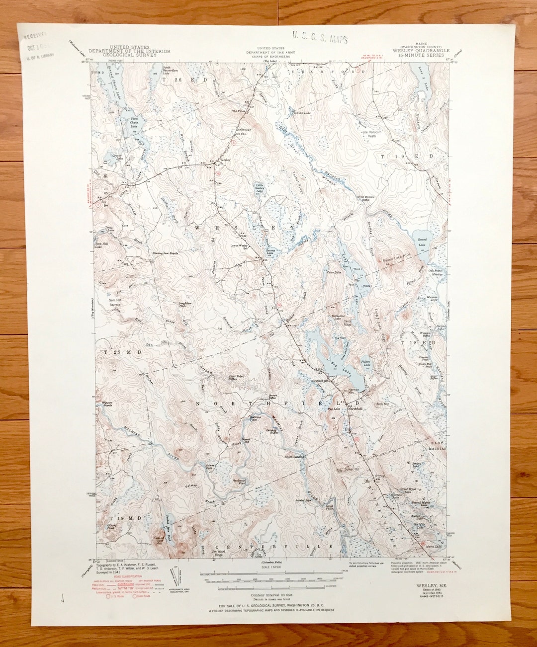

Antique Norridgewock, Maine 1943 US Geological store Survey Topographic Map – Rome, Mercer, Starks, Great Pond, North Pond, Smithfield, Vienna, ME
store Beautiful, antique map of Great Pond and surrounding Kennebec County and Somerset County area. This is an authentic 1943 print from the U.S. Geological Survey and NOT a computer reproduction.
See what Maine looked like almost 80 years ago. Lots of intricate details and geological contours. Map even has little squares for every house that existed at the time. The USGS cartographers were very thorough back then! On the back is a description of topographic symbols and map guide.
Perfect for the historian, map-lover, the curious or just as a conversation starter. Wonderful and rare. Vintage maps such as these make great gifts.
Edition of 1943, printed 1943
Dimensions: 16" width x 20" height
----
Features
Cities & Towns: Starks, Norridgewock, New Sharon, Mercer, Smithfield, Vienna, Mt. Vernon, Rome, Belgrade, Oakland, Sidney, Sandy River, East Mercer, Belgrade Lakes, North Belgrade.
Points of Interest: Great Pond, Kennebec River, North Pond, camp location of the North Pond Hermit, Little Pond, East Pond, Flying Pond, Long Pond, Ellis Pond, McGrath Pond, Messalonskee Lake, Sandy River, Bombazee Rips, Bigelow Hill, Little Beech Hill, The Plains, Hampshire Hill, McGaffey Mountain, Round Top Mt. Phillip, Sucker Brook, Howland Hill, Hoyt Island, Mosher Hill, Horse Point Snake Point, Foss Hill, Green Hill, Bog Stream, Mount Tom, Camp Abena Point, The Mountain, Maine Central Railroad and many more streams, ponds, villages and mountains.
Condition: Good Vintage condition, commensurate with age. This map is in incredible shape for being over 75 years old. Has light edge-wear and folds, as issued, but these will flatten easily and all will add to vintage character when framed.
----
We will happily adjust shipping price for multiple purchases. Maps are rolled up and shipped in sturdy mailing tubes, never folded.