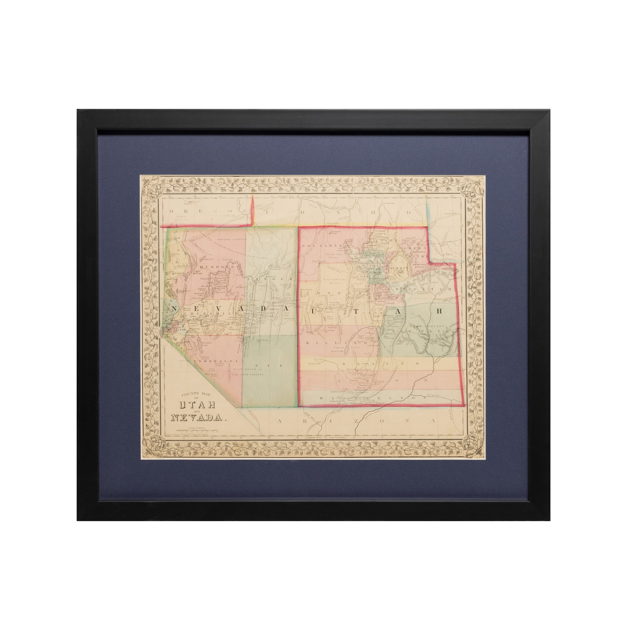


From the venerable Mitchell atlas, one of the most attractive atlases produced in the 19th century -- a visually stunning antique, hand-coloured map of Utah and Nevada. While admiring the map, keep in mind that all the coloured lines and filled-in colour were painstakingly done by hand.
Size: 15.5 inches x 12.5 inches. The full map is shown in the first photo.
Text at the bottom states "Entered according to Act of Congress, in the year 1867 by S. Augustus Mitchell, Jr. in the Clerks Office of the District Court of the U.S. for the Eastern District of Pennsylvania".
The map has an intricate vine motif border, typical for Mitchell atlases of that era. In very good condition; blank en verso. (Many old maps and prints may have minor tears, folds, warping, and other blemishes store that may not be clearly visible in our listing photos. Where possible, repairs have been made with archival mending tissue. If you have any specific concerns about the condition of the item, please do contact us before buying.)
For all things Nevada, click on:
https://www.etsy.com/ca/shop/bananastrudel?ref=seller-platform-mcnav&search_query=nevada
For all things Utah, click on:
https://www.etsy.com/ca/shop/bananastrudel?ref=seller-platform-mcnav&search_query=utah
This is an original map from 1867, not a modern reproduction! Bananastrudel sells only originals.
BMB5
Product code: 1867 Antique store Mitchell Map of Utah and Nevada - Rare Hand-Coloured Map